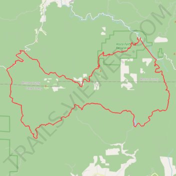
Gravel road around Alsea Falls
- Distance: 70.5 Km
- Elevation gain: 2,460 m
- Maximum elevation: 903 m
- Elevation loss: 2,463 m
- Minimum elevation: 104 m
- Moving time: 5 h 16 m
- Moving speed: 13.3 Km/h
- Maximum speed: 57.2 Km/h
- Total time: 5 h 56 m
- Global speed: 11.9 Km/h
Interactive trail map
Trail profile
- Distance: 70.5 Km
- Elevation gain: 2,460 m
- Maximum elevation: 903 m
- Elevation loss: 2,463 m
- Minimum elevation: 104 m
- Moving time: 5 h 16 m
- Moving speed: 13.3 Km/h
- Maximum speed: 57.2 Km/h
- Total time: 5 h 56 m
- Global speed: 11.9 Km/h
About this trail
Name: Gravel road around Alsea Falls trail, distance, elevation, map, profile, GPS track
Start: Fall Creek Access Road, Benton County, Oregon, United States (44.32161 -123.49035)
End: Alsea Falls Campground Road, Benton County, Oregon, United States (44.32130 -123.48711)
Coordinates: 44.22901 -123.65902 44.32161 -123.44991