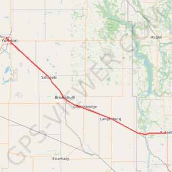
Import a GPX file

Yorkton - Russell

#Bike #Yorkton #Russell

  • Distance: 105.1 Km
  • Elevation gain: 235 m
  • Maximum elevation: 565 m
  • Elevation loss: 187 m
  • Minimum elevation: 412 m

Interactive trail map

Trail profile

  • Distance: 105.1 Km
  • Elevation gain: 235 m
  • Maximum elevation: 565 m
  • Elevation loss: 187 m
  • Minimum elevation: 412 m

About this trail

Name: Yorkton - Russell trail, distance, elevation, map, profile, GPS track

Start: Park Road, Yorkton, Saskatchewan, S3N 4B4, Canada (51.22428 -102.48327)

End: Lawrence Street West, Russell, Municipality of Russell – Binscarth, Manitoba, R0J 1W0, Canada (50.77700 -101.29042)

Coordinates: 50.76610 -102.48452 51.22457 -101.28717

Other hiking, mountain biking, running and outdoor activity trails

Click on a trail to view its statistics, map and profile.

Russell - Shoal Lake

Canada > Municipality of Russell – Binscarth > Russell

#Bike #Russell #Shoal

Distance: 77.6 Km • Elevation gain: 164 m • Maximum elevation: 599 m

Foam Lake - Yorkton

Canada > Saskatchewan > Foam Lake No. 276 > Foam Lake

#Bike #Foam #Yorkton

Distance: 91.0 Km • Elevation gain: 109 m • Maximum elevation: 563 m