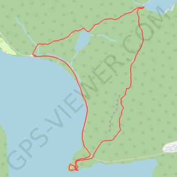
Rock Lake - Gordon Lake - Booth’s Rock Trail
Interactive trail map
Trail profile
- Distance: 5.8 Km
- Elevation gain: 188 m
- Maximum elevation: 496 m
- Elevation loss: 193 m
- Minimum elevation: 387 m
About this trail
Name: Rock Lake - Gordon Lake - Booth’s Rock Trail trail, distance, elevation, map, profile, GPS track
Coordinates: 45.50687 -78.39920 45.52284 -78.38366
Other hiking, mountain biking, running and outdoor activity trails
Click on a trail to view its statistics, map and profile.