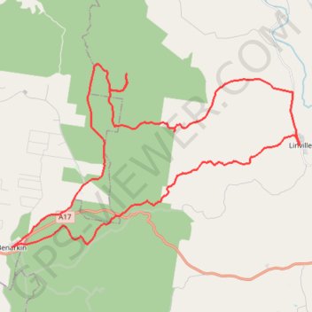
Linville Benarkin via Sandy Creek
Interactive trail map
Trail profile
- Distance: 49.7 Km
- Elevation gain: 802 m
- Maximum elevation: 485 m
- Elevation loss: 801 m
- Minimum elevation: 126 m
About this trail
Name: Linville Benarkin via Sandy Creek trail, distance, elevation, map, profile, GPS track
Start: George Street, Linville, Somerset Regional, Queensland, Australia (-26.84365 152.27597)
End: 32, George Street, Linville, Somerset Regional, Queensland, Australia (-26.84370 152.27600)
Coordinates: -26.88775 152.13648 -26.80875 152.27614
Other hiking, mountain biking, running and outdoor activity trails
Click on a trail to view its statistics, map and profile.