Tamolitch Blue Pool via McKenzie River Trail in Willamette National Forest
The hike to Tamolitch Blue Pool offers a captivating journey through diverse landscapes along the McKenzie River. Starting in an old-growth Douglas fir forest, the trail crosses a stream on a wooden bridge and leads to expansive lava fields. The trail culminates at the mesmerizing blue pool, set against the surrounding cliffs, where the McKenzie River emerges from beneath a lava flow, creating a serene and picturesque spot. #Hiking #River #Forest #Nature #Lake
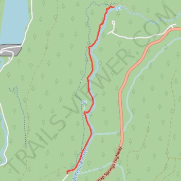
- Distance: 5.9 Km
- Elevation gain: 105 m
- Maximum elevation: 743 m
- Elevation loss: 106 m
- Minimum elevation: 684 m
- Moving time: 1 h 16 m
- Moving speed: 4.6 Km/h
- Maximum speed: 10.4 Km/h
- Total time: 1 h 17 m
- Global speed: 4.6 Km/h
Interactive trail map
Trail profile
- Distance: 5.9 Km
- Elevation gain: 105 m
- Maximum elevation: 743 m
- Elevation loss: 106 m
- Minimum elevation: 684 m
- Moving time: 1 h 16 m
- Moving speed: 4.6 Km/h
- Maximum speed: 10.4 Km/h
- Total time: 1 h 17 m
- Global speed: 4.6 Km/h
About this trail
Name: Tamolitch Blue Pool via McKenzie River Trail in Willamette National Forest trail, distance, elevation, map, profile, GPS track
Start: Forest Road 2672-655, Linn County, Oregon, United States (44.29036 -122.03566)
Coordinates: 44.29031 -122.03585 44.31233 -122.02718
Other hiking, mountain biking, running and outdoor activity trails
Click on a trail to view its statistics, map and profile.
Northern part of the Pacific Crest Trail (PCT)
United States > Oregon > Klamath County
Hike on the Pacific Crest National Scenic Trail from Crater Lake to Canada Border through Oregon and Washington along the Sierra Nevada and Cascade mountain ranges. #Hiking #Mountain #SierraNevada #Cascade #Nature #Forest #Park #PCT
Distance: 1,198.3 Km • Elevation gain: 44,308 m • Maximum elevation: 2,307 m