Little Mashel Falls Trail via Bud Blancher Trail
The Bud Blancher Trail to Little Mashel Falls offers hikers a journey through serene forested areas, leading to the impressive Upper, Middle, and Lower Falls. The trail is well-maintained, though it can become muddy and slippery near the waterfalls, so appropriate footwear is recommended. #Hiking #Waterfall #Forest #Nature #River
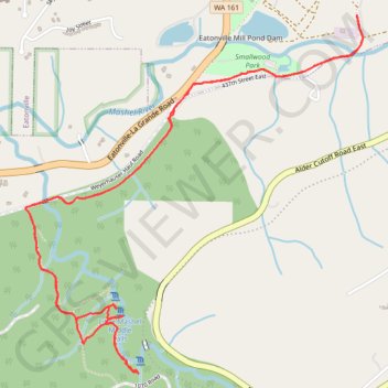
- Distance: 6.8 Km
- Elevation gain: 201 m
- Maximum elevation: 344 m
- Elevation loss: 202 m
- Minimum elevation: 236 m
- Moving time: 1 h 43 m
- Moving speed: 3.9 Km/h
- Maximum speed: 7.9 Km/h
- Total time: 1 h 50 m
- Global speed: 3.7 Km/h
Interactive trail map
Trail profile
- Distance: 6.8 Km
- Elevation gain: 201 m
- Maximum elevation: 344 m
- Elevation loss: 202 m
- Minimum elevation: 236 m
- Moving time: 1 h 43 m
- Moving speed: 3.9 Km/h
- Maximum speed: 7.9 Km/h
- Total time: 1 h 50 m
- Global speed: 3.7 Km/h
About this trail
Name: Little Mashel Falls Trail via Bud Blancher Trail trail, distance, elevation, map, profile, GPS track
Coordinates: 46.84691 -122.27870 46.86161 -122.25854