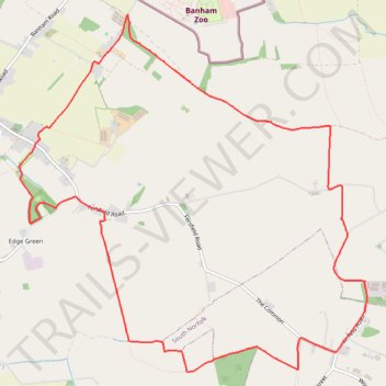
Loop walk from Kenninghall
- Distance: 12.6 Km
- Elevation gain: 59 m
- Maximum elevation: 56 m
- Elevation loss: 59 m
- Minimum elevation: 35 m
- Moving time: 2 h 39 m
- Moving speed: 4.7 Km/h
- Maximum speed: 11.4 Km/h
- Total time: 2 h 50 m
- Global speed: 4.4 Km/h
Interactive trail map
Trail profile
- Distance: 12.6 Km
- Elevation gain: 59 m
- Maximum elevation: 56 m
- Elevation loss: 59 m
- Minimum elevation: 35 m
- Moving time: 2 h 39 m
- Moving speed: 4.7 Km/h
- Maximum speed: 11.4 Km/h
- Total time: 2 h 50 m
- Global speed: 4.4 Km/h
About this trail
Name: Loop walk from Kenninghall trail, distance, elevation, map, profile, GPS track
Coordinates: 52.41377 1.00174 52.44342 1.04909