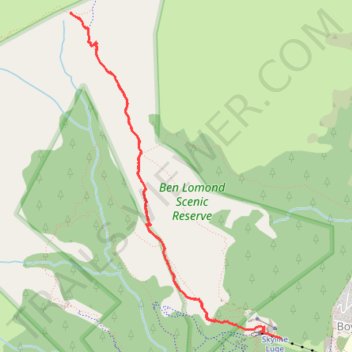
Ben Lomond Track to Saddle in Ben Lomond Scenic Reserve
- Distance: 7.6 Km
- Elevation gain: 558 m
- Maximum elevation: 1,307 m
- Elevation loss: 723 m
- Minimum elevation: 672 m
- Moving time: 2 h 30 m
- Moving speed: 3.0 Km/h
- Maximum speed: 11.8 Km/h
- Total time: 3 h 10 m
- Global speed: 2.4 Km/h
Interactive trail map
Trail profile
- Distance: 7.6 Km
- Elevation gain: 558 m
- Maximum elevation: 1,307 m
- Elevation loss: 723 m
- Minimum elevation: 672 m
- Moving time: 2 h 30 m
- Moving speed: 3.0 Km/h
- Maximum speed: 11.8 Km/h
- Total time: 3 h 10 m
- Global speed: 2.4 Km/h
About this trail
Name: Ben Lomond Track to Saddle in Ben Lomond Scenic Reserve trail, distance, elevation, map, profile, GPS track
Coordinates: -45.02709 168.62798 -45.00214 168.65091