Anhinga Loop Trail in Everglades National Park
The Anhinga Loop Trail is an excellent choice for those seeking an easy yet rewarding nature walk. As you traverse its boardwalks and paved pathways, you can expect to observe a variety of wildlife, including alligators basking in the sun, anhingas and cormorants gliding gracefully through the air, and turtles sunning themselves along the edges. The trail offers expansive views over sawgrass marshes and freshwater sloughs, making it a prime spot for birdwatching, especially in the cooler months when wildlife gathers near water sources. #Hiking #Loop #Forest #Lake #Nature
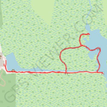
- Distance: 1.3 Km
- Elevation gain: 0 m
- Maximum elevation: 2 m
- Elevation loss: 0 m
- Minimum elevation: 2 m
- Moving time: 32 m 45 s
- Moving speed: 2.4 Km/h
- Maximum speed: 4.1 Km/h
- Total time: 39 m 28 s
- Global speed: 2.0 Km/h
Interactive trail map
Trail profile
- Distance: 1.3 Km
- Elevation gain: 0 m
- Maximum elevation: 2 m
- Elevation loss: 0 m
- Minimum elevation: 2 m
- Moving time: 32 m 45 s
- Moving speed: 2.4 Km/h
- Maximum speed: 4.1 Km/h
- Total time: 39 m 28 s
- Global speed: 2.0 Km/h
About this trail
Name: Anhinga Loop Trail in Everglades National Park trail, distance, elevation, map, profile, GPS track
Coordinates: 25.38197 -80.60947 25.38345 -80.60544