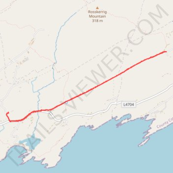
Old road from Kilcrohane to Ahakista
- Distance: 6.0 Km
- Elevation gain: 93 m
- Maximum elevation: 89 m
- Elevation loss: 93 m
- Minimum elevation: 23 m
- Moving time: 1 h 33 m
- Moving speed: 3.8 Km/h
- Maximum speed: 5.4 Km/h
- Total time: 1 h 49 m
- Global speed: 3.3 Km/h
Interactive trail map
Trail profile
- Distance: 6.0 Km
- Elevation gain: 93 m
- Maximum elevation: 89 m
- Elevation loss: 93 m
- Minimum elevation: 23 m
- Moving time: 1 h 33 m
- Moving speed: 3.8 Km/h
- Maximum speed: 5.4 Km/h
- Total time: 1 h 49 m
- Global speed: 3.3 Km/h
About this trail
Name: Old road from Kilcrohane to Ahakista trail, distance, elevation, map, profile, GPS track
Start: Seefin, West Cork, County Cork, Munster, Ireland (51.58474 -9.69255)
End: Seefin, West Cork, County Cork, Munster, Ireland (51.58472 -9.69256)
Coordinates: 51.58349 -9.69300 51.59347 -9.65618
Other hiking, mountain biking, running and outdoor activity trails
Click on a trail to view its statistics, map and profile.
Farranamanagh Loop Walk
Distance: 3.6 Km • Elevation gain: 72 m • Maximum elevation: 82 m