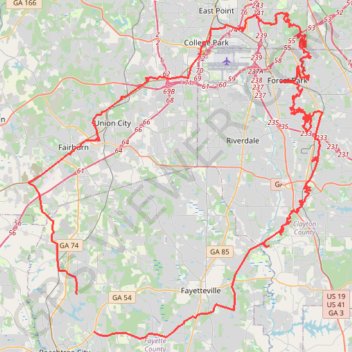
Morrow, Forest Park, Atlanta, Fairburn
- Distance: 186.0 Km
- Elevation gain: 1,824 m
- Maximum elevation: 325 m
- Elevation loss: 1,840 m
- Minimum elevation: 239 m
- Moving time: 8 h 31 m
- Moving speed: 21.8 Km/h
- Maximum speed: 52.2 Km/h
- Total time: 9 h 6 m
- Global speed: 20.4 Km/h
Interactive trail map
Trail profile
- Distance: 186.0 Km
- Elevation gain: 1,824 m
- Maximum elevation: 325 m
- Elevation loss: 1,840 m
- Minimum elevation: 239 m
- Moving time: 8 h 31 m
- Moving speed: 21.8 Km/h
- Maximum speed: 52.2 Km/h
- Total time: 9 h 6 m
- Global speed: 20.4 Km/h
About this trail
Name: Morrow, Forest Park, Atlanta, Fairburn trail, distance, elevation, map, profile, GPS track
Coordinates: 33.40838 -84.62566 33.67715 -84.33328
Other hiking, mountain biking, running and outdoor activity trails
Click on a trail to view its statistics, map and profile.
Atlanta, Lilburn, Yellow River Park, Panola, Jonesboro
United States > Georgia > Fayette County > Peachtree City > Stop
Distance: 335.0 Km • Elevation gain: 4,058 m • Maximum elevation: 338 m
Powder Springs, Allatoona trails, Dallas, Chatt Hills
United States > Georgia > Fayette County > Tyrone > Stop
Distance: 319.6 Km • Elevation gain: 3,805 m • Maximum elevation: 379 m
Newnan, Moreland, Brooks gravel
United States > Georgia > Fayette County > Peachtree City
Distance: 181.4 Km • Elevation gain: 1,737 m • Maximum elevation: 310 m