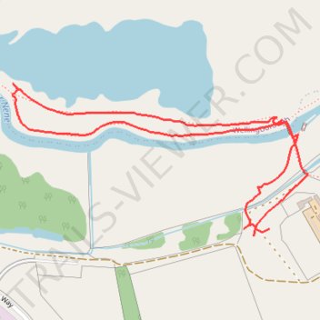
Loop walk along River Nene around Chester House area
- Distance: 1.8 Km
- Elevation gain: 8 m
- Maximum elevation: 47 m
- Elevation loss: 8 m
- Minimum elevation: 39 m
- Moving time: 43 m 55 s
- Moving speed: 2.5 Km/h
- Maximum speed: 5.1 Km/h
- Total time: 48 m 24 s
- Global speed: 2.2 Km/h
Interactive trail map
Trail profile
- Distance: 1.8 Km
- Elevation gain: 8 m
- Maximum elevation: 47 m
- Elevation loss: 8 m
- Minimum elevation: 39 m
- Moving time: 43 m 55 s
- Moving speed: 2.5 Km/h
- Maximum speed: 5.1 Km/h
- Total time: 48 m 24 s
- Global speed: 2.2 Km/h
About this trail
Name: Loop walk along River Nene around Chester House area trail, distance, elevation, map, profile, GPS track
Coordinates: 52.29188 -0.66248 52.29445 -0.65428
Other hiking, mountain biking, running and outdoor activity trails
Click on a trail to view its statistics, map and profile.
Wellingborough Waendel Walk walk
United Kingdom > England > North Northamptonshire > Wellingborough > Little Irchester
Distance: 16.2 Km • Elevation gain: 141 m • Maximum elevation: 102 m
42 Km walk around Wellingborough
United Kingdom > England > North Northamptonshire > Wellingborough > Little Irchester
Distance: 41.7 Km • Elevation gain: 308 m • Maximum elevation: 115 m
The Jo Cox Way 2022 Day 3 Market Bosworth to Milton Keynes
United Kingdom > England > Leicestershire > Hinckley and Bosworth > Market Bosworth
Distance: 122.9 Km • Elevation gain: 953 m • Maximum elevation: 195 m