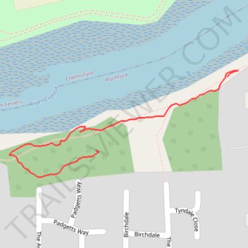
Kendal Park Walk
- Distance: 0.6 Km
- Elevation gain: 10 m
- Maximum elevation: 13 m
- Elevation loss: 4 m
- Minimum elevation: 3 m
- Moving time: 8 m 38 s
- Moving speed: 4.0 Km/h
- Maximum speed: 6.6 Km/h
- Total time: 16 m 42 s
- Global speed: 2.1 Km/h
Interactive trail map
Trail profile
- Distance: 0.6 Km
- Elevation gain: 10 m
- Maximum elevation: 13 m
- Elevation loss: 4 m
- Minimum elevation: 3 m
- Moving time: 8 m 38 s
- Moving speed: 4.0 Km/h
- Maximum speed: 6.6 Km/h
- Total time: 16 m 42 s
- Global speed: 2.1 Km/h
About this trail
Name: Kendal Park Walk trail, distance, elevation, map, profile, GPS track
Coordinates: 51.62820 0.60831 51.62955 0.61300