Sonoran Desert National Monument
Mountain Bike in Sonoran Desert National Monument and North Maricopa Mountains Wilderness from West Butterfield Road Parking. #MTB #Desert #Nature
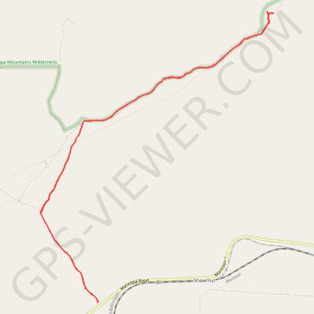
- Distance: 15.2 Km
- Elevation gain: 122 m
- Maximum elevation: 471 m
- Elevation loss: 122 m
- Minimum elevation: 363 m
- Moving time: 1 h 6 m
- Moving speed: 13.7 Km/h
- Maximum speed: 35.6 Km/h
- Total time: 1 h 12 m
- Global speed: 12.7 Km/h
Interactive trail map
Trail profile
- Distance: 15.2 Km
- Elevation gain: 122 m
- Maximum elevation: 471 m
- Elevation loss: 122 m
- Minimum elevation: 363 m
- Moving time: 1 h 6 m
- Moving speed: 13.7 Km/h
- Maximum speed: 35.6 Km/h
- Total time: 1 h 12 m
- Global speed: 12.7 Km/h
About this trail
Name: Sonoran Desert National Monument trail, distance, elevation, map, profile, GPS track
Start: BLM 8004, Maricopa County, Arizona, United States (32.99365 -112.52298)
End: BLM 8004, Maricopa County, Arizona, United States (32.99361 -112.52296)
Coordinates: 32.99361 -112.53312 33.03731 -112.49137