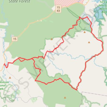
Great Sandy National Park - Toolara Forest
#MTB #Loop #GreatSandy #Toolara
- Distance: 88.4 Km
- Elevation gain: 927 m
- Maximum elevation: 102 m
- Elevation loss: 929 m
- Minimum elevation: 6 m
Interactive trail map
Trail profile
- Distance: 88.4 Km
- Elevation gain: 927 m
- Maximum elevation: 102 m
- Elevation loss: 929 m
- Minimum elevation: 6 m
About this trail
Name: Great Sandy National Park - Toolara Forest trail, distance, elevation, map, profile, GPS track
Coordinates: -26.13358 152.78037 -25.96933 153.02628
Other hiking, mountain biking, running and outdoor activity trails
Click on a trail to view its statistics, map and profile.
Harrys Hut - Neebs Waterhole
Great Sandy National Park. #MTB #Loop #GreatSandy
Distance: 50.3 Km • Elevation gain: 476 m • Maximum elevation: 95 m